Pauri Garhwal, a district of Uttarakhand as well as part of the Western Himalaya
situated between 29° 45’ to 30°15’ Latitude and 78° 24’ to 79° 23’ E Longitude having
tehsils Lansdown, Kotdwar, Thalisain, Chobattakhal, Srinagar,
Satpuli, Dhumakot & Yamkeshwar.
situated between 29° 45’ to 30°15’ Latitude and 78° 24’ to 79° 23’ E Longitude having
tehsils Lansdown, Kotdwar, Thalisain, Chobattakhal, Srinagar,
Satpuli, Dhumakot & Yamkeshwar.
 |
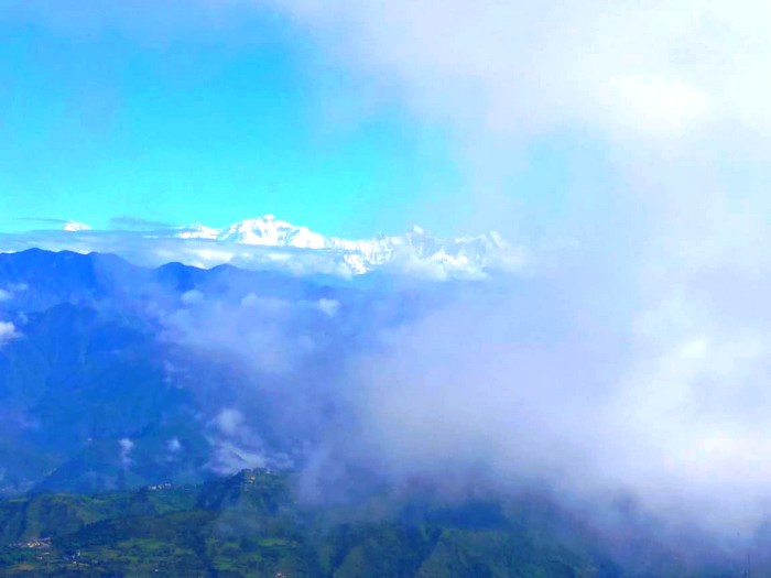
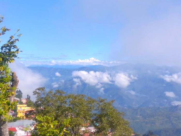
| Beautiful picture was taken in the rainy season By Mr. Rohit Rawat. |

Pauri is the headquarter of Pauri Garhwal district and is located at the height of 1650 m. and
has a population of 24,743. This is fairly located on high altitude amongst the Deodar forest
and on the northern slopes of the ridge, which provide one of the ice-clad mountain chains
has a population of 24,743. This is fairly located on high altitude amongst the Deodar forest
and on the northern slopes of the ridge, which provide one of the ice-clad mountain chains

Alaknanda River (Nayyar) is the major river of the district and is one of the major
tributaries of Alaknanda which is called Nayyar after the confluence of Eastern and
Western Nayyar at Satpuli Both the Nayyars originate from the Dudatoli range and
drain their water to the south.
tributaries of Alaknanda which is called Nayyar after the confluence of Eastern and
Western Nayyar at Satpuli Both the Nayyars originate from the Dudatoli range and
drain their water to the south.

The high ranges in the Nayyar catchments are Thailisain (Dudatoli – Chakisain ridge)
Baijro (Pokhra – Demdeval ridge), Khirsu-Mandakhal (Pauri – Adwani – Kanskhet ridge)
Bironkhal (Lansdowne – Gumkhal – Dwarikhal ridge) & Rathwadhab
(Dugadda – Kandi ridge).
Baijro (Pokhra – Demdeval ridge), Khirsu-Mandakhal (Pauri – Adwani – Kanskhet ridge)
Bironkhal (Lansdowne – Gumkhal – Dwarikhal ridge) & Rathwadhab
(Dugadda – Kandi ridge).

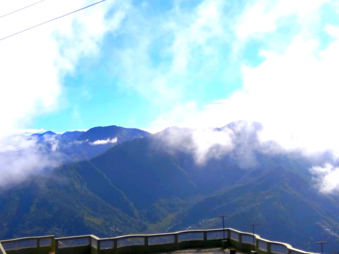
The entire region of the Pauri Garhwal is mountainous. The highest point of the area
is 3116 mtrs Dudatoli range and the lowest point of the area is 295 mtrs near chilla.
The village located at the hightest level is Dobri, which is 2480 mtrs high.
The forest cover is the maximum in Thailisain block and the minimum in the Pauri block.
Most of the part of the area is approachable by road from its district headquarter. Most
of these roads are not yet metalled and are prone to landslips, slides, dusty,
except few main roads.
of these roads are not yet metalled and are prone to landslips, slides, dusty,
except few main roads.

The occurrence of diverse topographical and climatic factors has resulted in the
remarkable biodiversity of the district as a result of which flora also correspondingly differs
over its different parts. Forests dominate in the phyto-geography and also constitute the
most valuable natural resource of the district.
over its different parts. Forests dominate in the phyto-geography and also constitute the
most valuable natural resource of the district.

The district of Pauri Garhwal as part of the Western Himalaya presents a unique set
of ecological characteristics over a complex variety of systems that incorporate forests,
of ecological characteristics over a complex variety of systems that incorporate forests,
meadows, savannah grasslands, marshes, and rivers, as well as wildlife, geology and
several other phytogeographically distinctive peculiarities.
Climate
The region has a sub-temperate to the temperate climate, which remains pleasant throughout the year. The maximum temperature recorded in the month of june is 45°C at Kotdwar while in the higher reaches at Dudhatoli it only rises to 25°C. Temperature descends to a minimum of 1.3°C in January and means monthly temperature for the region ranges from 25°C to 30°C. The hilly terrain with its densely forested slopes receives adequate rainfall generally commencing from mid-June and extending till mid-September. Occasional rainfall is also recorded in winter. Average annual rainfall in the district is 218 cm., about 90 percent of which is generally concentrated over the monsoon. Relative humidity varies between 54 and 63 percent. The higher reaches receive some snow in winter when the temperature falls to freezing point.
Comments
Post a Comment